
ESSAY · HISTORY OF DATAVIZ · NIGHTINGALE
John Chappelsmith's map of the 1852 tornado
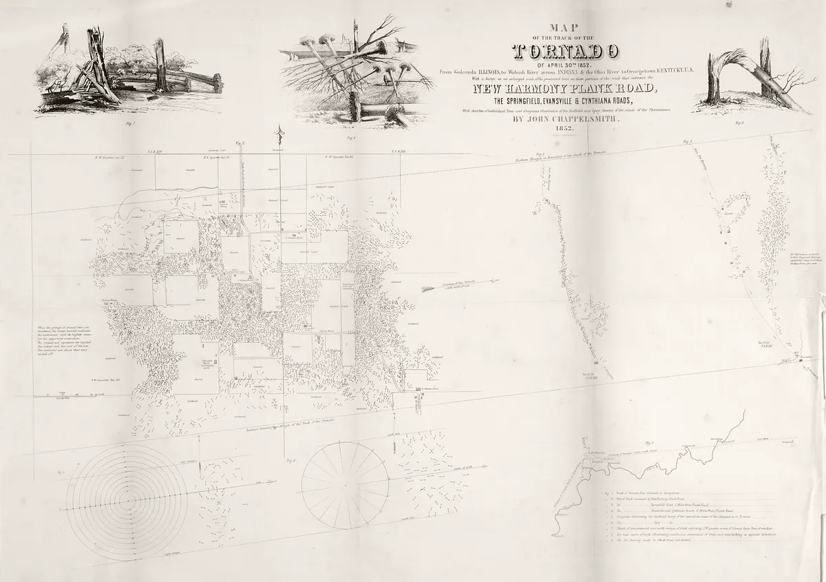
In 1852 John Chappelsmith mapped a tornado’s path near New Harmony, Indiana, for the Smithsonian, recording which way the trees fell across a square mile. His theory of the storm was wrong, but his way of building an argument from evidence still holds up. A close reading from the Data Visualization Society’s Historical Viz channel.